Research
Urban Typology Clustering
A machine learning pipeline that clusters buildings by urban typology using OpenStreetMap and Google Earth 3D data, surfacing outlier plots with untapped development potential.
- Year
- 2025
- Role
- Researcher & Developer
- Tools
- Grasshopper · Python

About this project
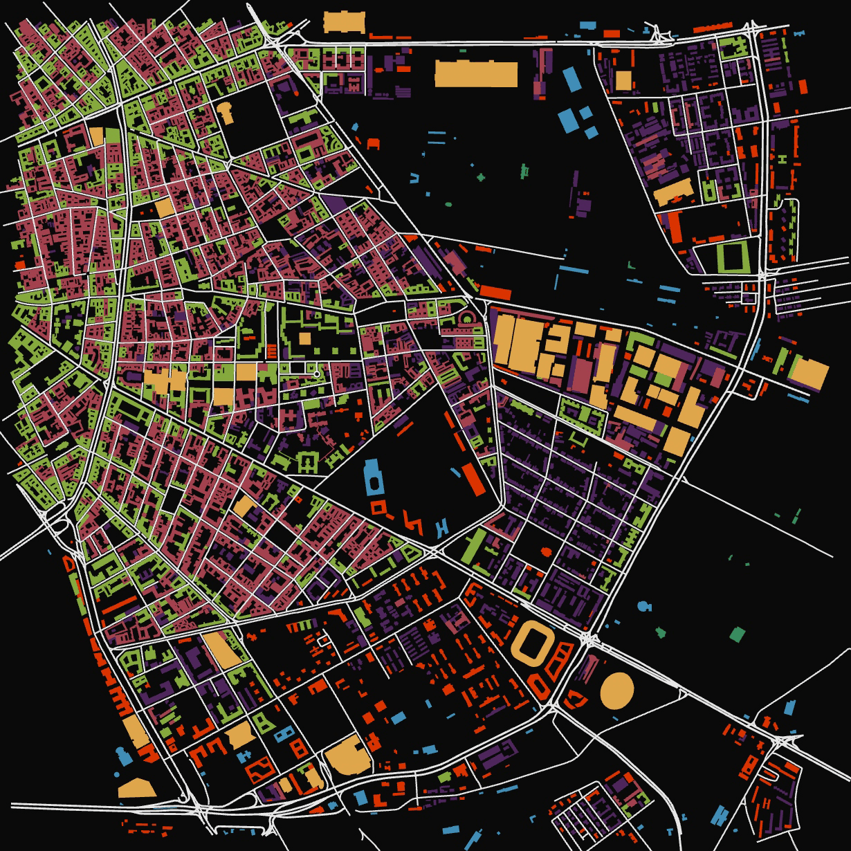
This project began with a simple discovery: Google Earth's 3D data can be imported directly into Rhino. From there, I built a Grasshopper workflow that reconstructs 3D models of city neighbourhoods using OpenStreetMap and Google Earth geometry, creating a parametric representation of buildings and their urban context.
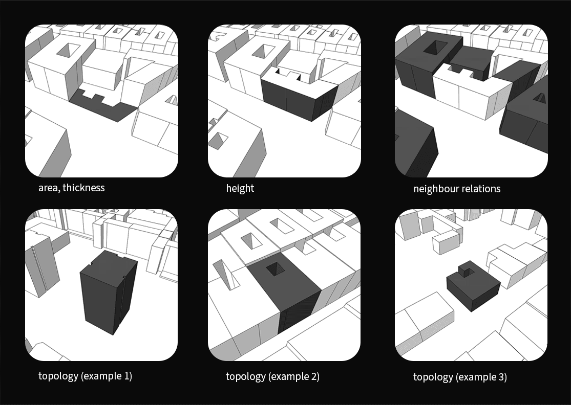
On top of that model, I developed a machine learning clustering pipeline that groups buildings by morphology and typology — how they sit within the street and block network, their scale, and their relationship to their surroundings. By comparing each building to the dominant local pattern, the system flags outliers: buildings that don't fit their context, often revealing underbuilt plots where zoning permits significantly larger development.
The project was both a practical tool for surfacing hidden development potential and a deep dive into machine learning applied to urban form.
data sources
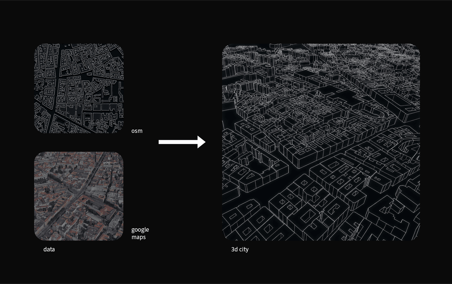
morphology data
example findings
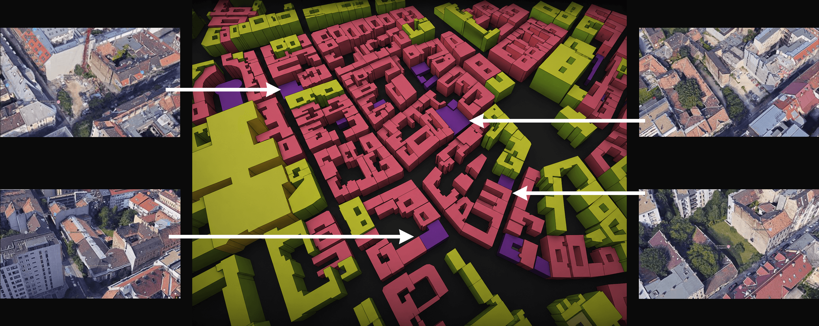
example map