Computational Tools
Plan-Pal ai
An AI-assisted site study tool that turns a polygon drawn on satellite imagery into a generated masterplan, extracted building footprints, and a 3D massing model with live FAR and coverage checks.
- Year
- 2026
- Role
- Founder & Developer
- Tools
- Claude Code · Python
About this project
I built PlanPal AI as a browser-based tool for the earliest, fuzziest phase of a real-estate project — the point where a developer has a plot and a rough programme, but no design to test it against. The user draws the site boundary on satellite imagery, sets the local regulations (FAR, height limits, coverage) and the intended programme, and the tool carries that brief through a full pipeline to a measurable 3D result. Fifteen built-in project templates — from a transit-oriented mixed-use plaza to a perimeter block, a suburban subdivision or an eco-resort — fill in a complete brief scaled to the actual drawn area, so a scenario can be set up in seconds and then adjusted by hand.
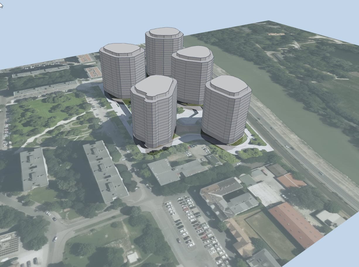
The pipeline chains several AI models together. The masked satellite view is first turned into a black-and-white masterplan drawing, then a language model writes a site-specific image prompt from the brief and the real geographic context of the plot, and an image model generates a top-down development design that stays inside the site boundary. A segmentation model extracts the building footprints from that design, which are simplified and georeferenced back to real-world coordinates, and a language model proposes a floor structure — underground levels, ground floor, typical floors, roof — for each individual building. The result is a Three.js massing model of the whole site.
Because everything stays georeferenced, the design can be measured rather than just looked at: gross floor area, floor area ratio, site coverage and building height are computed from the model itself and checked against the regulation inputs, updating as the floor specifications are edited. The intent is to compress the first days of a feasibility study — sketching, massing, area take-offs — into a loop short enough that many alternatives can be tested instead of one.